


Indigenous Mapmaking, or Bringing a Dead Map to Life
Excerpted from In the Shadow of the Palms: More-Than-Human Becomings in West Papua. © 2022 Duke University Press. Reprinted with permission from Duke University Press.
The book In the Shadow of the Palms tells the story of how one group of people has encountered a plant that has radically upended their forest-based way of life. Over the past several decades, Indigenous Marind in the Indonesian-controlled region of West Papua have seen this introduced plant—oil palm—expand across their customary forests, lands, and territories in the form of industrial plantations.
Drawing from my long-term ethnographic fieldwork as an anthropologist and my work in human rights advocacy, the book recounts the experiences and perspectives of Marind villagers from three rural settlements in West Papua—Khalaoyam, Mirav, and Bayau—as they reckon with the arrival of monocrops and climate-change induced extreme weather events, including a major drought. [1] [1] Pseudonyms have been used for all places and people for reasons of security.
The book explores how oil palm developments undermine Marind’s intimate and ancestral relationships to kindred plants and animals, at the same time they reconfigure Marind’s sense of place, time, and personhood. It focuses on the ambivalent place of oil palm: Marind resent the plant for its destructive environmental impacts—but also pity it for its own violent subjection to human and technological exploitation. Ultimately, the book is a vital story of Indigenous creativity and persistence in the face of entrenched and emergent systems of racism and capitalism that threaten their survival.
In the following excerpt, Marind share their critiques of government maps that flatten the landscape, and they offer alternative Indigenous cartographies that bring mapmaking back to life.
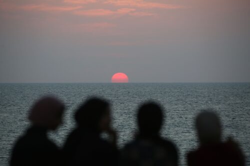
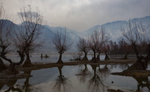
A group of Khalaoyam community members and I gathered to rest in the shade of a mango tree near Bayau village. We had just returned from a three-day fishing trip on the western banks of the Bian River in the West Papuan district of Merauke. As they passed around slivers of baked sago pith and coconut meat, my friends started discussing the drought. Several pointed to the shriveled rambutans and jackfruit littering the ground. They compared the withered fruit to the peeling skin of their forearms. The drought, my companions affirmed, was the longest in decades.
They vehemently agreed with Claudia, an elderly woman and traditional midwife, that oil palm was to blame. Oil palm, Claudia explained, was grabbing the waters of the Bian, just like it was grabbing the land of Marind. Oil palm was sucking the soil and rivers dry. Soon, she exclaimed, the forest would be just dust and scars.
Claudia’s impassioned diatribe was interrupted by Paulinus, an energetic young villager, who came running toward us with a bulky cardboard box, hollering, “I found another map! Check it out!”
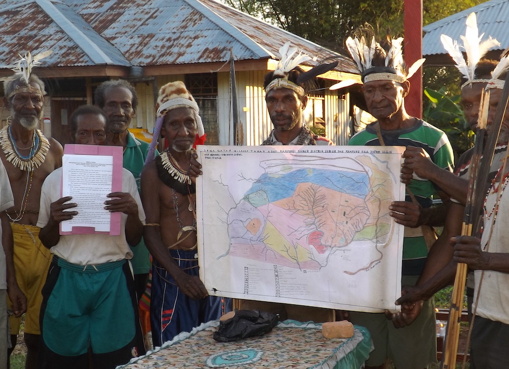
Paulinus, who was known in Khalaoyam for his sharp wit and savviness, described with satisfaction how he had successfully convinced a representative of the Merauke Board for Planning and Regional Development to lend him the document at a recent oil palm promotion event in the city. The group was excited. Communities in the Upper Bian have limited access to official maps. Those they do possess have been difficult to acquire. Some were stealthily pocketed from the shelves of government offices during cigarette breaks at multistakeholder meetings. Others were photographed covertly during negotiations with agribusiness companies using HD spy cameras in half-frame reading glasses given to community members by technologically savvy Jakartan nongovernmental organizations.
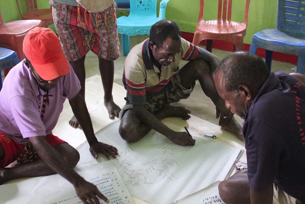
Paulinus carefully pulled out the laminated A3 map. Claudia’s husband, Paolo, stood guard in front of the platform where we were seated. He wanted to make sure intel hired by the oil palm companies did not intrude on our gathering. While taking photographs of the map with my phone, I listened to the group’s cartographic critique.
“When I look at this map, I don’t know where I am. I don’t know who is around me. I cannot hear the birds,” said Marcus.
Crouched beside me, Claudia used a callused finger to follow the color-coded straight lines carving up the landscape into a series of overlapping geometric shapes: administrative regions, oil palm and timber concessions, military zones, transmigration sites, palm oil mills. The lines on the map segmented vast swaths of forest into nondescript squares and rectangles, classified in the legend according to their productivity type: Permanent Production Forest, Limited Production Forest, Convertible Production Forest, Industrial Plantation Forest, Timber Forest Concession, and many more.
Blank patches, where my friends told me “natural forest” (hutan alam in Indonesian) was still standing, were labeled as “degraded land” (tanah terlantar in Indonesian)—a designation under Indonesian law for areas deemed available for industrial development. Over 60 agribusiness company names lined the bottom of the map, each of which owned one or more concessions in the “degraded” zones. A few shaded squares were labeled “protected areas” (kawasan lindung in Indonesian). Claudia told me that Marind were prohibited from entering these areas—including the sacred sago groves and hunting sites within them—because “the government is in control.”
The group went silent. Then, Claudia shook her head and said, “There are no straight lines in nature [pada alam itu garis lurus tiada in Indonesian].”
The group nodded affirmatively. Beny, Claudia’s younger brother, turned to me and explained:
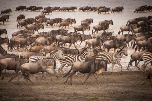
“Nothing moves in straight lines. Look at the seasonal flight of the birds. The journey of the cassowary. The monsoonal movement of the fish and prawns. The way the sago reproduces following the curve of the Bian River. The way amai [plant and animal kin in Marind] and anim [humans in Marind] today follow this movement to feed and protect themselves. Look at the flow of the Bian—swaying right, then left, then right again, it has direction, but it is not rigid. Straight lines exist only on the road, in the army, in oil palm plantations. Nothing grows in straight lines, except oil palm. Oil palm plantations are modern forests.”
Beny further contrasted the straight lines of the map to the fluidity of customary boundaries that follow natural markers and the movements of plants, humans, and animals as they grow and multiply.
His sister, Claudia, added:
“We, too, have borders between our territories, but these move with the movements of those who inhabit them—the birds, animals, sago, and Marind. Permission is needed to cross these boundaries, but it is not given by the government or companies. Permission is given to us by amai [plant and animal kin]. They, too, are landowners. You might not have your KTP [ID card in Indonesian] at hand or any shoes on your feet. But if you show your skin and follow the voices of amai, then the forest and its beings will let you through. This is the way amai and Marind have lived together since time immemorial.”
Then, Marcus, a young man from Mirav with whom I frequently went to gather medicinal herbs in the forest, turned to me and asked, “Miss, can you make this map alive?”
Confused, I looked to the others for help, but their rephrasing of the question—“Can you give this map some life? Can you bring it to life?”—failed to make it clear to me.
Marcus explained:
“You see, it’s like this. This map, I think, is what the government and companies see. Just straight lines and oil palm. But there is something dead about this map. What I mean is that there is no sign of life. This map is not alive [hidup in Indonesian]. It is dead. There are no people or birds or animals or plants on it. Just patches of color that don’t mean anything. Everything just sort of stands still. Everything is flat. When I look at this map, I don’t know where I am. I don’t know who is around me. I cannot hear the birds. Do you know what I mean?”
I tried to explain to Marcus that maps could not include everything for reasons of scale and detail, and tended to feature fixed locations in the landscape rather than their mobile inhabitants. But Marcus insisted that without that kind of “life,” the map was pretty much useless.
Borrowing my pen, he started to show me what it meant to make the map alive. Faintly at first, then more pronounced, the weaving line of his hand traced on the map the paths of kindred plants and animals of his clan across forest and marshland. Then, Marcus added the locations where interclan peacemaking rituals, warfare, and congregations had taken place; the funerary sites of great warriors of the past; and the routes of the migratory tekle bird along with the places where it rested, fed, and mated.
Claudia, Beny, and other members of the group joined in, adding to Marcus’ lines a meshwork of other meandering trajectories: the aquatic journey of the angli-angli fish, followed closely by that of its predator, the swooping manhuk bird; the amphibious proliferation of sago suckers weaving along the fluid contours of swamp and mangrove; and the flight of the wallaby during slash-and-burn clearing, followed by its inquisitive return in the wet season to feed on juicy shoots in the forest regrowth.
As the lines, arrows, arcs, and scribbles multiplied, administrative boundaries gradually disappeared in a dense overgrowth of intertwined human and other-than-human paths. Taking turns wielding the pen, my friends subverted the state’s fixed representation of space by torquing its straight lines into lines of life.
This excerpt has been edited slightly for length, style, and clarity.

Sophie Chao is a Discovery Early Career Research Award fellow and lecturer in anthropology at the University of Sydney in Australia. Her anthropological and interdisciplinary research investigates the intersections of Indigeneity, ecology, capitalism, health, and justice in the Pacific. Chao previously worked for the human rights organization Forest Peoples Programme in Indonesia, supporting the rights of forest-dwelling Indigenous peoples to their customary lands, resources, and livelihoods. Her forthcoming book, In the Shadow of the Palms: More-Than-Human Becomings in West Papua, received the Duke University Press Scholars of Color First Book Award in 2021.
