


Taking Cultural Preservation to a New Dimension
This article was originally published at The Conversation and has been republished under Creative Commons.
THESE DAYS, IF YOU want to visit remarkable archaeological sites, such as Great Zimbabwe or Petra in Jordan, you don’t even need to leave your house.
3D scanning technology has improved in leaps and bounds in the last two decades and has become much more affordable. This has led to numerous archaeological and heritage sites appearing online in interactive 3D platforms, such as Sketchfab. Unlike still images and videos, 3D models offer enhanced interaction, enabling users to navigate and perceive a place from various perspectives.
But while technology has raced ahead, there is a noticeable lag in the establishment of best practice guidelines within the field.
We are a multidisciplinary team made up of a geomatician, an architect, and two archaeologists. In a recent article, we examined the implications of current scanning technology and sought to answer the question: Can people avoid repeating the mistakes of the past when digitizing cultural locations?
One criticism of current 3D models of archaeological sites is that they are devoid of human traces and history. The pursuit of objectivity in scientific endeavors is the norm. But in using 3D technology—making decisions about site boundaries, what is cleaned from the model, and the chosen level of detail—a subjective filter is introduced. The omission of human usage and cultural traces renders these representations static and sterile. This inadvertently strips sites of the very culture they aim to preserve.
In our research, we sought to offer an alternative approach—one that aligns with Indigenous archaeology—where Indigenous knowledge and scientific methods are blended. To do so, we undertook a case study by digitizing a site in South Africa that is of profound cultural and spiritual importance to many who live in that area. The results highlighted that, with considered approaches, researchers can help keep the vibrant culture of meaningful places alive, even when they’re brought into the digital world.
A PLACE WITH POTENCY
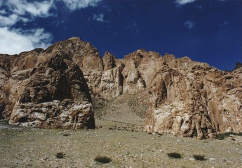
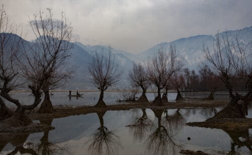
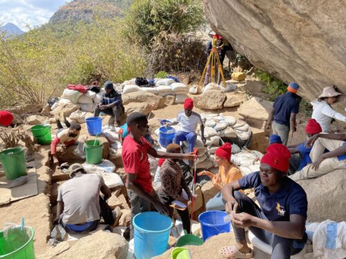
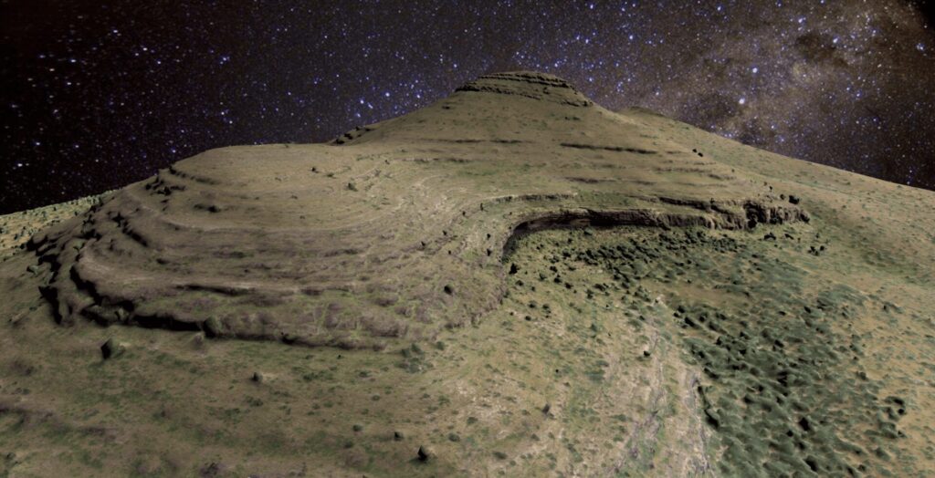
Ga-Mohana Hill is situated close to a small town called Kuruman in a semiarid region in the north of South Africa. We chose the site as our case study because of its rich cultural and archaeological significance. It has two significant rockshelters that are located at opposite sides of the hill: Ga-Mohana Hill North Rockshelter, facing northwest, and Ga-Mohana Hill South Rockshelter, facing southeast.
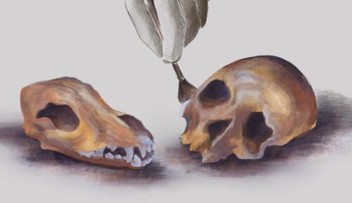
The south rockshelter preserves rock art and archaeological traces from the Later Stone Age. In the north shelter, archaeologists have recovered material dating to 105,000 years ago, including ostrich eggshell fragments, stone tools, and a cache of calcite crystals.
Today Ga-Mohana Hill holds profound cultural significance for the local community. While this cultural heritage endures, its prominence has been diminishing due to various sociopolitical factors. One of us, Sechaba Maape, grew up in the area and has actively worked to restore Ga-Mohana as a meaningful place from a cultural perspective. Reflecting on his youth, Maape recounts Traditional Stories of Noga ya Metsi, the Great Snake, residing in the rockshelters and engaging in abductions and supernatural activities that unsettled the community.
These narratives contributed to the places acquiring a frightening reputation. Interestingly, the secrecy surrounding the locations dissuades many in the community from visiting them, though the sites have been used for various initiation rituals. And today, the landscapes at Ga-Mohana Hill are used by church groups and other community members for spiritual communion and prayer sessions. Traditional healers and tourists also visit Ga-Mohana.
These multiple uses and its rich archaeological heritage mean that Ga-Mohana is a place of deep meaning and can be considered a living heritage site. We therefore wanted to create an online, interactive 3D digital replica that represented its multiple uses. Ultimately, our aim was to manifest the potency that this place holds within the 3D model rather than merely representing its archaeological and scientific value.
A NEW APPROACH TO 3D MODELS
Our approach was to focus on three elements: first, the agency that this place holds—the ability to act upon people to give and receive meaning; second, the proximity the 3D model gives to the physical site and to past and present people and their cultures; and third, the multivocal nature of the site—that is, telling the different stories of this place so all relevant voices can be heard.
To achieve this, we conducted a 3D scan of Ga-Mohana Hill and its shelters by acquiring photogrammetric images by drone and hand-held cameras. The images were processed to produce an optimized 3D model suitable for web-based applications. The 3D model was then augmented with a number of visual devices, along with customized text in the form of rotating signboards.
The Great Snake is represented as a moving shadow on the shelter wall. Candles were placed in the 3D version of the shelter to symbolize the site’s ongoing religious aspects.
To represent the archaeology, a number of artifacts that were excavated were 3D scanned and then digitally placed into the 3D model to show where they were found—in a sense, returning them to their original context. Other visual devices include a hearth, flowing tufas (ancient waterfalls), enhanced rock art, and animated engravings. All the visual devices were designed to be moving, to animate the place and show its vitality.
We also created a website to contextualize and introduce the 3D model and warn people who may not want to visit the model for cultural reasons and because of its ritual potency.
WHAT WE’VE LEARNED
Based on what we’ve learned from this project, we proposed an approach that prioritizes the digitization of place—with all its meanings and vitality—over space, or simply inert geometry that emphasizes agency, proximity, and multivocality.
A shift is needed from a purely objective approach to 3D documentation toward representing the space as a meaningful place to a public audience. This involves acknowledging and portraying cultural, social, and political contexts. By avoiding the privileging of one voice over others, our aim is to subvert dominant viewpoints and promote inclusivity.
The study also underscores the significance of archaeological visualization in reshaping perceptions of the past and contributing to the formation of present identities.

Stephen Wessels is a geomatician and virtual reality specialist with an M.Sc. in geomatics in which he created a 3D virtual site visit of Petra, Jordan. From 2007 to 2020, he worked at the Zamani project, where he became a chief scientific officer in the School of Architecture, Planning, and Geomatics, University of Cape Town, South Africa. He has 12 years of experience creating digital 3D models of heritage sites using laser scanning, photogrammetry, and panorama photography and has documented over 200 heritage sites in Africa, the Middle East, and Asia. In 2018, Wessels developed the Rock Art Portal, where he integrates spatial data of rock art sites with contextual data to create an interactive medium for education.

Benjamin Schoville is a research fellow in the Centre for Heritage and Culture at the University of Southern Queensland, Australia, and previously was a lecturer in archaeology at the University of Queensland. He held a Centre of Excellence in Palaeosciences postdoctoral fellowship at the University of Cape Town, South Africa, after receiving his Ph.D. from Arizona State University. Through field excavations and rigorous experimental studies, his research has led to major discoveries of stone-tipped spears from 500,000 years ago and complex stone tool technologies from 72,000 years ago. Schoville’s current project explores the southern Kalahari Basin for early modern human archaeological and paleoanthropological remains and includes excavations at middle Stone Age sites at Ga-Mohana Hill and on the Tswalu Kalahari Reserve.

Jayne Wilkins is a paleoarchaeologist and Discovery Early Career Research Fellow at the Australian Research Centre for Human Evolution, Griffith University, Australia. She researches the origins of human adaptation, social learning, and sociality. Wilkins approaches her studies from three directions: archaeological excavation, lithic analysis, and experimental archaeology.

Sechaba Maape is a senior lecturer in the School of Architecture and Planning at the University of the Witwatersrand, South Africa, and a convener of the bachelor’s of architecture program at the school. He coordinates and teaches the award-winning first-year architecture design course, where students draw out alternative realities using tools from Indigenous knowledge systems from South Africa. He also teaches the history and theory of architecture, and supervises the master’s of architecture and master’s in urban studies in sustainable and energy efficient cities program, where he explores alternative paradigms toward sustainable cities. Maape works closely with professional archaeologists, paleontologists, and Indigenous knowledge practitioners as part of the knowledge fields by which he draws insights for design.
