


What Google Maps Don’t Show You

When I was a boy, my father and I used to plan road trips together. We would go to our local American Automobile Association (AAA) office and get stacks and stacks of maps (which were “free”—with a paid membership, of course). State maps, city maps, country maps. Once I had them, I felt like the road trip had already begun.
Today, with three boys of my own, I still like to plan and take road trips. But the planning now is totally different. Instead of going to the AAA days or weeks in advance, we simply open Google Maps on our phones. We type in a destination, learn the fastest route, and find out about the best places to visit. My sons feel the excitement, and I still do too—but not as much as when I was a kid. Without paper maps, the discovery inherent in old-school planning is somehow missing for me. The process now just isn’t as adventurous or inspiring.
My relationship to maps, and by extension the American landscape, is largely prosaic. If I need to go somewhere, I locate those places, all of which have English, Spanish, or occasionally French names, and that doesn’t strike me as odd or disturbing. But I’m a product of dominant, English-speaking American society. What if my ancestors’ history had been erased by English and Spanish colonialism? What if my culture had a different relationship with the landscape? Whose maps should I use then? Probably not AAA’s or Google’s.
That was the problem that Jim Enote, director of the A:shiwi A:wan Museum and Heritage Center at Zuni Pueblo in northwestern New Mexico, sought to address more than a decade ago. He recognized the conceptual and political power of maps, but realized that while modern American maps will get him from place to place, they fail to record and present the landscape in a meaningful way from the perspective of a culturally literate Zuni. Put another way, modern maps don’t record places important to Zuni history, cosmology, ecology, and religion.
To rectify this situation, Enote conceived of the Zuni Map Art Project. He commissioned Zuni artists to make maps of the American Southwest from a Zuni perspective. He told them that scale doesn’t matter, that putting north at the top was nothing more than a cultural construct from Europe, and that they could orient the maps as they saw fit. For Jim, it was the stories, the vignettes, that were important to record. The project team ultimately created 31 maps for a traveling exhibition that went to the Museum of Northern Arizona in Flagstaff, the American Museum of Natural History in New York, and the Fowler Museum at the University of California, Los Angeles.
The pieces that came out of the project are beautiful, and they portray a great deal of Zuni history and heritage. There was one important area, though, that didn’t appear on any of the maps—the region around Reserve, New Mexico, a small town 140 miles south of Zuni Pueblo.
From 1939 to 1955, Paul Martin and John Rinaldo of the Field Museum in Chicago worked in the Reserve area, excavating dozens of ancient “Mogollon” sites in the process. (Archaeologists call the pre-Columbian culture “Mogollon” after a small town 40 miles south of Reserve.)
In 1964, Rinaldo published a paper titled “Notes on the Origins of Historic Zuni Culture” in which he proposed a direct connection between the Mogollon and the Zuni, based solely on his archaeological research. Had Rinaldo talked to the Zunis (he didn’t), his conclusion would not have been news to them, because they know their ancestors traveled all across the American Southwest, including through the Reserve area, before settling in the “Middle Place,” which is now Zuni Pueblo.
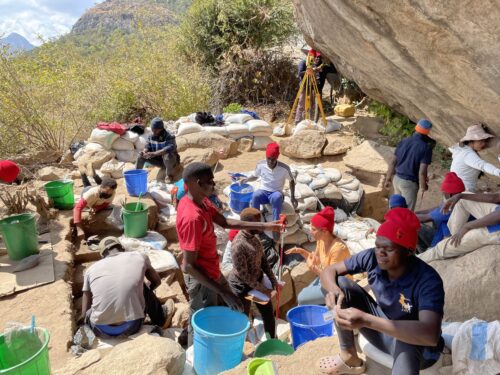
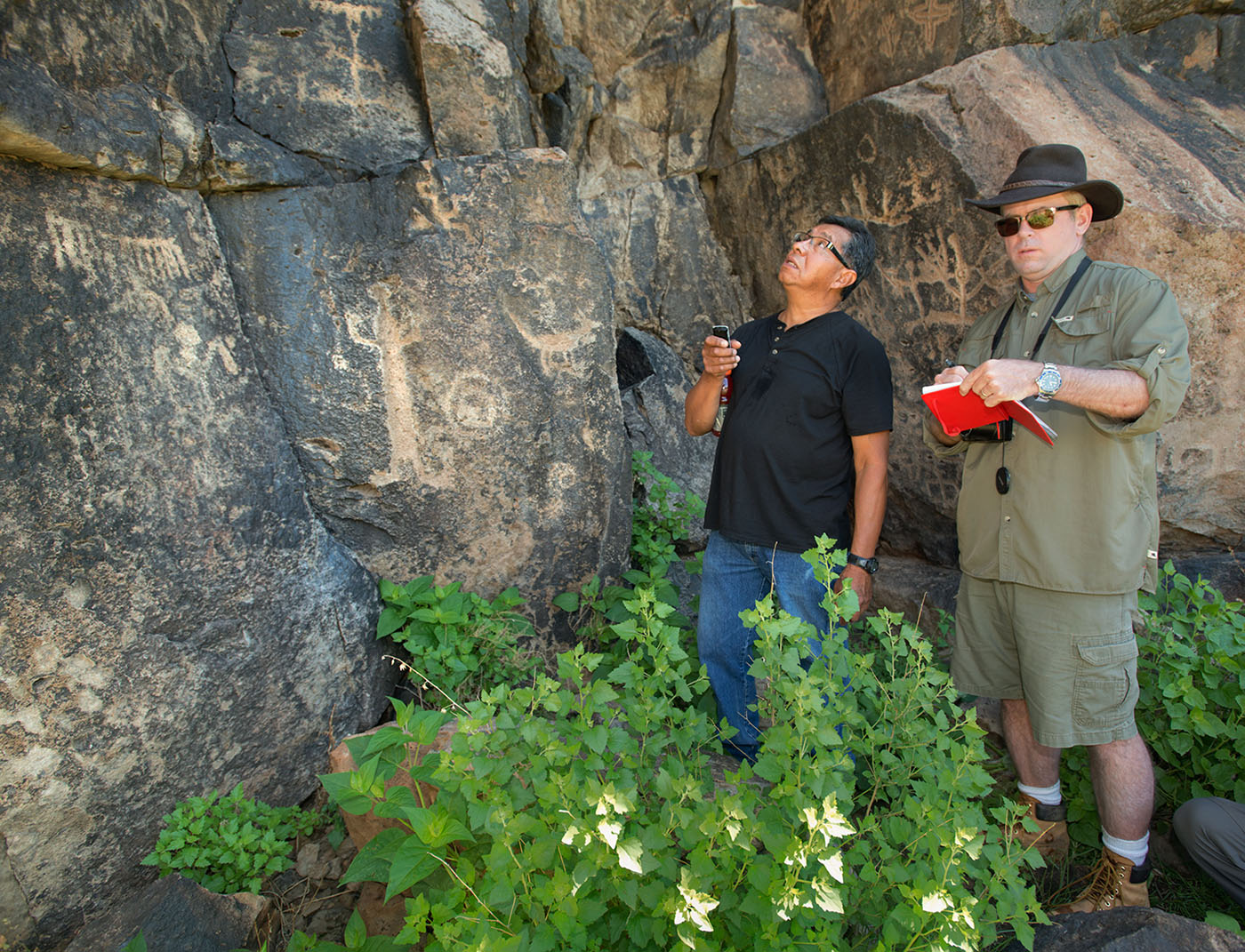
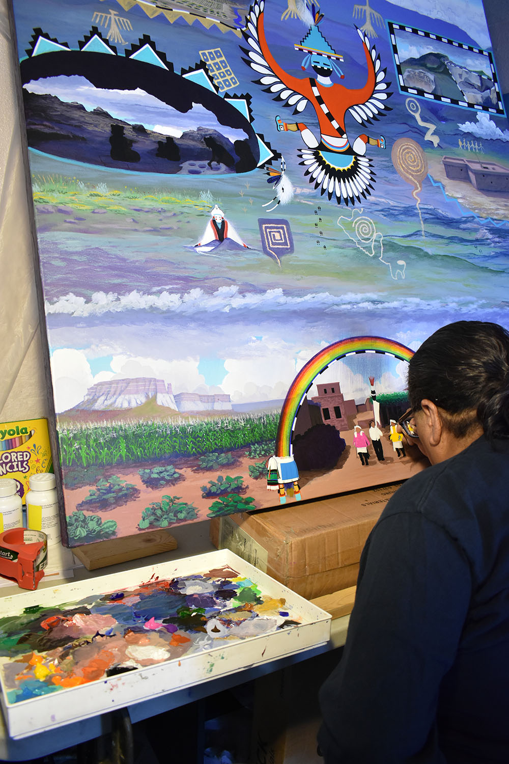
In 2011, I began a systematic archaeological effort to relocate and document the sites Martin and Rinaldo excavated. In 2015, I invited Octavius Seowtewa of the Zuni Cultural Resources Advisory Team to join me, and we have been collaborating ever since. When we realized that the Reserve area wasn’t represented in any of the Zuni Map Art pieces, we decided to get one made. In 2017, I found funding; Octavius enlisted Ronnie Cachini to paint the piece. The three of us then toured the Reserve area together. I focused on teaching them about the archaeological sites; they focused on teaching me about hunting and Zuni understandings of the region. Ronnie recently finished a remarkable map that will soon go on display at the Denver Museum of Nature & Science, where I work.
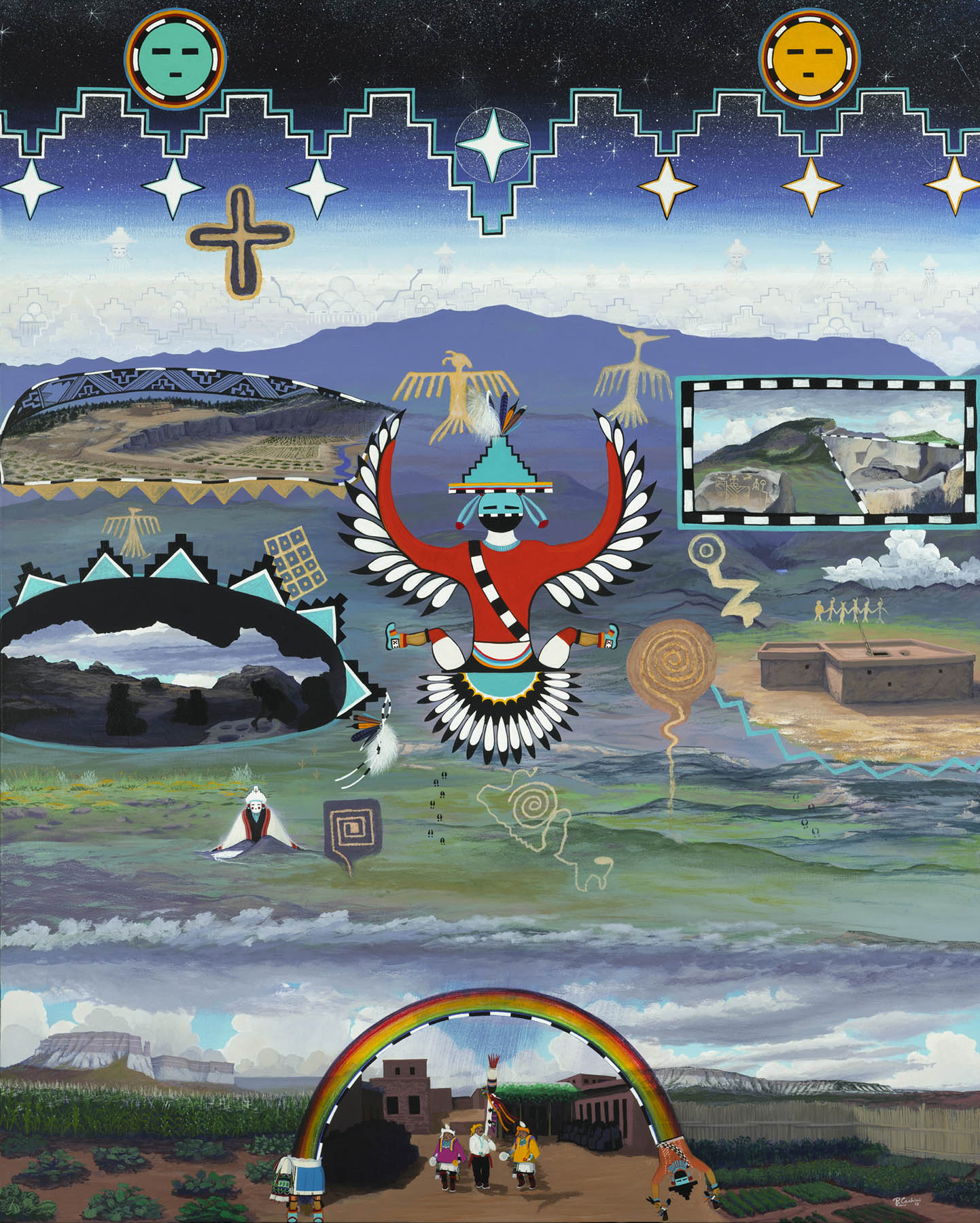
Ronnie’s painting has three horizontal parts. The bottom third offers a view from Zuni Pueblo looking south towards Reserve, with a harvest dance occurring beneath a rainbow.
The top third contains stylized versions of the moon, sun, Milky Way, and a supernova—possibly from A.D. 1054—that rock art panels across the Southwest document. The sacred mountain in the background is Eagle Peak, the tallest in the region.
From my narrow, archaeological perspective, the middle of the painting is the most important, because that’s where Ronnie put his renditions of some of the most significant archaeological sites in the area. At lower left is Tularosa Cave, which Martin and Rinaldo excavated in 1950. Zuni ancestors used (but did not live in) this cave for over 2,000-years. Because it is perpetually dry, the artifacts recovered from the site are exquisite, including more than 280 sandals, toy bows and arrows, and 33,000 corn cobs, some with kernels still on them! Note that Ronnie painted four black silhouettes of women grinding corn in the cave. Where I saw an archaeological site, Ronnie saw ancestors at work. Below Tularosa Cave sits Salt Woman, an important deity, at Zuni Salt Lake, with a trail leading to her precious saline resources.
Read more from the archives: “Ladders to Other Worlds.”
The Tularosa rock art panel is depicted in the upper left. That panel contains an amazing array of symbols that Octavius, Ronnie, and their colleagues say records much of Zuni history. All of the symbols in Ronnie’s painting—the supernova, thunderbirds, grids, spirals, dancers, animal tracks, etc.—are copied from the panel.
In the upper right is a small cliff-dwelling located high in a mountain southwest of Reserve, as well as a small rock art panel from a boulder next to a U.S. Forest Service road.
In the lower right is Ronnie’s reconstruction of the Toriette Lakes great kiva, a threatened ceremonial structure that we excavated in May 2018 and to which we will return in 2019.
The stunning, dramatic, central figure in the painting is a thunderbird originally designed by Teddy Wyaki, Ronnie’s great-great-grandfather-in-law, in the 19th century. Ronnie asked his family for special permission to use the design on his map.
Despite my best intentions to always be aware of other cultural perspectives, when I first saw Ronnie’s draft of the painting, I was shocked that he put Tularosa Cave in the bottom left. “Tularosa Cave is located in the far northeast of our project area,” I protested. “It should be in the upper right of the painting!” When I finished expressing my dismay, Ronnie gave me a knowing, wry smile and quietly said, “The painting is oriented looking south from Zuni Pueblo. Northeast is at bottom left. All the sites are in their proper position.”
I’ll admit, I’m a creature of my own upbringing. I will always expect north to be up on my maps and in my world. As a historian of science and an anthropologist, however, I know it hasn’t always been that way. Early European maps, for example, had east at the top. Indeed, the term “to orient” originally meant to put east (the Orient from Europe’s perspective) at the top of a map. I learned that fact in 1987, when my father took me to a lecture on the history of mapmaking.
The Zuni Map Art Project has reinvigorated my interest in maps. My dad died more than a decade ago, so alas, he can’t share in this renewed passion. I have no doubt, though, that he would’ve loved Ronnie’s painting as much as I do.
As for my sons, they will continue to orient themselves with their phone-based apps, of course, but I’m going to introduce them to the astounding variety of maps humans have come up with—and to the many wonderful ways of navigating the human experience.
